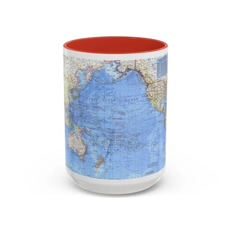
Pacific Ocean (1969) (Map) The Pacific Ocean (1969) map is a cartographic representation of the vast water body, the Pacific Ocean. Produced in 1969, this particular map offers a detailed visual depiction of the ocean's geographical features at that time, including its boundaries, islands, and notable landmarks along its coastlines. This map serves as a historical record and a valuable resource for studies related to marine geography, navigation, and climate science. It is noteworthy for its precision in capturing the Pacific Ocean's expansive topography and its role in shaping global geopolitics and weather patterns during the late 20th century.
Express delivery and return policies
Free shipping on orders over $30
Processing time: 1-2 Days
Shipping time: 3-5 Days(According to the logistics method and delivery address)
Items can be returned or exchanged within 30 days !


![Dralnu's Crusade [Planeshift]](https://img.glamocelets.shop/77/3981/2025050714/dralnu-s-crusade-planeshift.webp)